
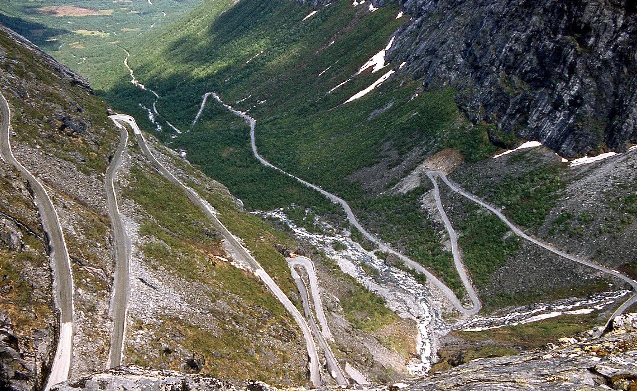
Trollstigen: Opening Dates, Driving Tips and Route Plan
Plan Trollstigen: when the road is open, how to drive the 11 hairpins, vehicle limits, time needed and what to do if it is closed.
On this page
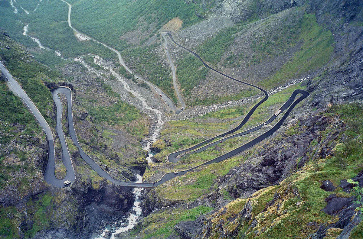
Last updated November 2026: Trollstigen is a hairpin mountain road on County Road 63 between Åndalsnes and Valldal, with 11 bends up a steep mountainside. It is open only in summer, and recent seasons have started late, on 17 June in 2024 and 11 July in 2025. Check live status on the Statens vegvesen traffic pages before you book anything non-refundable.
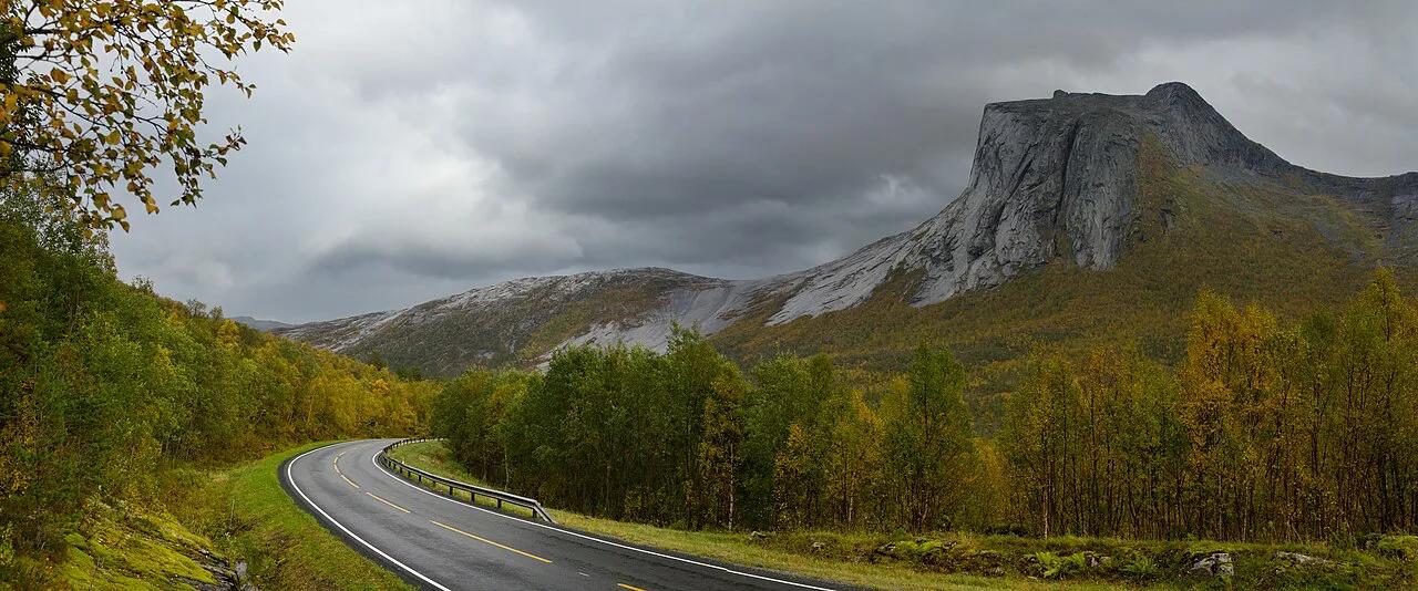
Featured image: W. Bulach, CC BY-SA 4.0, via Wikimedia Commons.
Trollstigen at a Glance
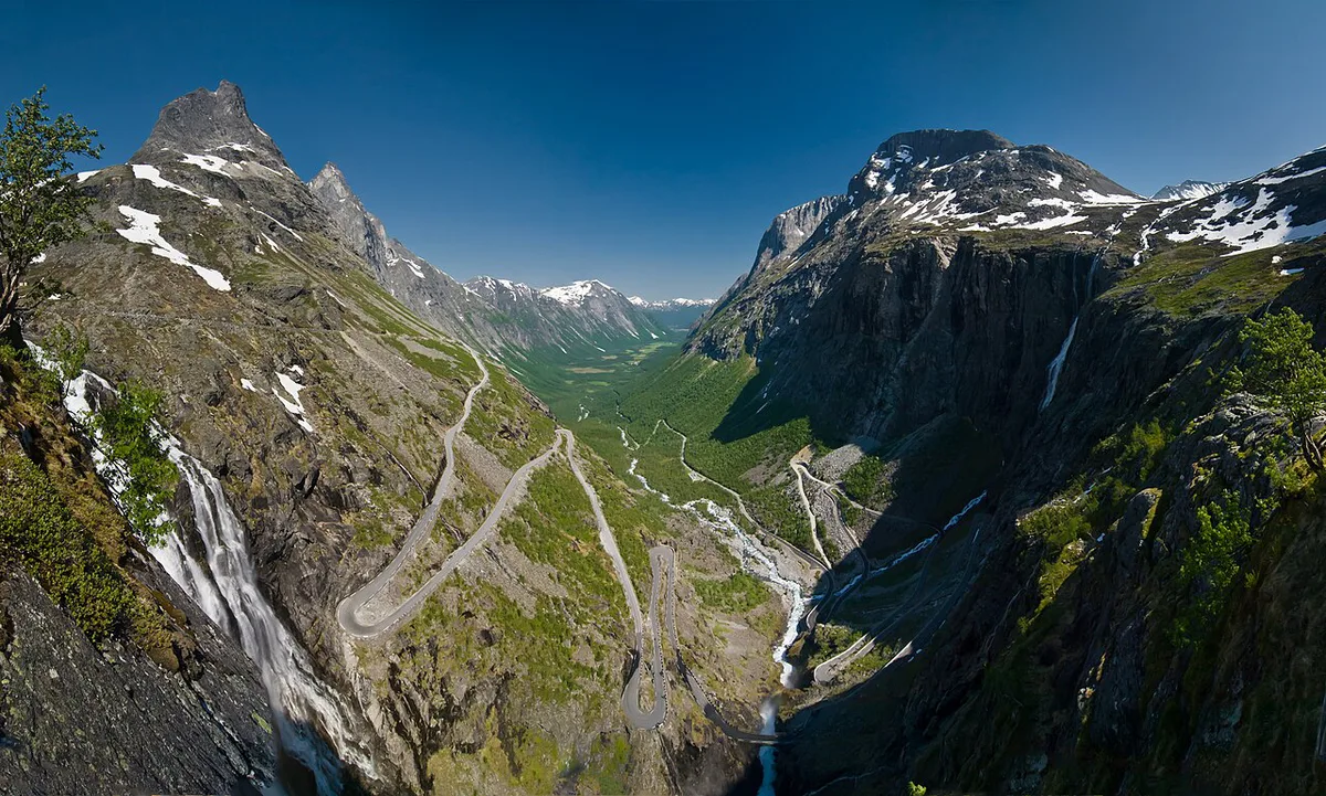
Trollstigen means "troll path" and lies in Rauma Municipality, Møre og Romsdal. Part of County Road 63, it links Åndalsnes with Valldal and forms one stretch of the Geiranger–Trollstigen National Tourist Route. King Haakon VII opened the road on 31 July 1936. Its visitor centre and viewing platforms opened on 16 June 2012.
Trollstigen is one of the 18 Norwegian Scenic Routes, yet its 2026 outlook runs only to 15 August.
| Fact | Detail | Source |
|---|---|---|
| Location | Åndalsnes to Valldal, County Road 63 | Nasjonale turistveger |
| Hairpin bends | 11 | Nasjonale turistveger, VisitNorway |
| Gradient | About 10% | Wikipedia |
| Full scenic route | 104 km (about 65 miles), Sogge Bru to Langvatnet | Nasjonale turistveger |
| Sea crossing | 1 ferry, Eidsdal to Linge | Nasjonale turistveger |
| Bus length limit | 13.3 m (about 44 ft) on the official route page | Nasjonale turistveger |
| Fee to drive | None reported for the stretch | Fjord Norway |
When Is Trollstigen Open? Season Risk and Live Status
Norway's route authority describes a normal season as mid-May until the first autumn snow. Recent years have not followed that pattern. In 2024 the road opened on 17 June after rockfall. In 2025 it opened on 11 July and closed on 15 August for roadworks. Published outlooks for 2026 and 2027 point to 1 June to 15 August, again with roadworks, and Norwegian press reported a multi-year rock-securing programme. Treat those dates as a planning signal, not a promise. Heavy rain or rockfall risk can also close the road at short notice, and the VisitNorway opening guide says the same. Past official winter logs list openings on 29 April and 12 June, and closures on 5 October and 7 December.
- Book refundable lodging for any night that depends on crossing Trollstigen.
- Aim for June, July or early August, before the 15 August closure date reported for 2026.
- Check Statens vegvesen traffic messages the evening before and again that morning.
- Keep one spare day in the itinerary for a closure or a fog-bound plateau.
Is Trollstigen Worth It? Who Should Go and Who Should Skip
Go if you want 11 hairpins, a waterfall beside the road and two architect-designed viewpoints in one short stretch. Skip or shorten it when the schedule has no buffer, because a closure or a queue can swallow half a day. Nervous mountain drivers should also think twice. The road is narrow, and summer traffic is heavy. Wet or foggy days remove the main reward, which is the view down the bends. On those days, a stop at the plateau for coffee may not justify the detour.
- Go: confident drivers with a flexible day and clear weather in the forecast.
- Shorten: itineraries that only allow a quick look at the viewpoints.
- Skip: low-cloud days, or trips where the road is closed and no fallback day exists.
Driving Trollstigen: The Road, Vehicle Limits and Direction
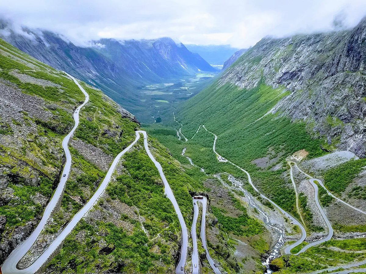
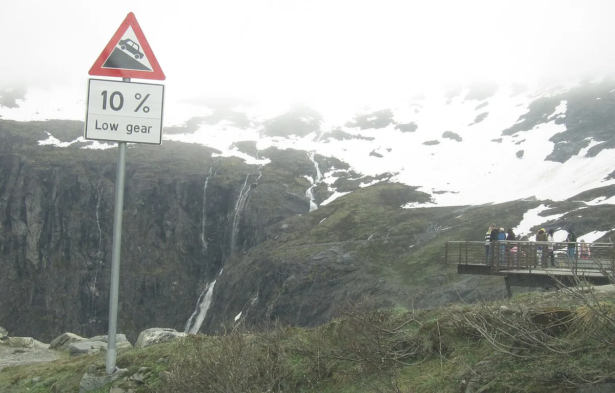
Trollstigen is narrow, with a 10% gradient and many sharp bends. Several bends were widened between 2005 and 2012, but passing still needs patience. Vehicle length is the key restriction. Wikipedia reports a 12.4 m (41 ft) limit, while the official route page gives 13.3 m (44 ft) for buses. Motorhomes and tour coaches should confirm the current figure with Statens vegvesen before committing. Campervan renters can start with our campervan hire guide. Car renters will find pickup and insurance basics in our car rental guide. American drivers can read how a US license works in Norway. Rest-area toilets do not accept motorhome waste, and the nearest dump stations are at Isterdalen, Valldal and Geiranger. Keep to the posted limits, which our Norway speed limits guide explains.
- Åndalsnes to Valldal: you climb the bends, so you see the hairpins from inside the road.
- Valldal to Åndalsnes: you reach the plateau first and descend the bends toward Romsdalen.
- Pick the direction that matches your overnight stop, ferry timing and the light you want.
What to See at the Trollstigen Plateau and Along the Route
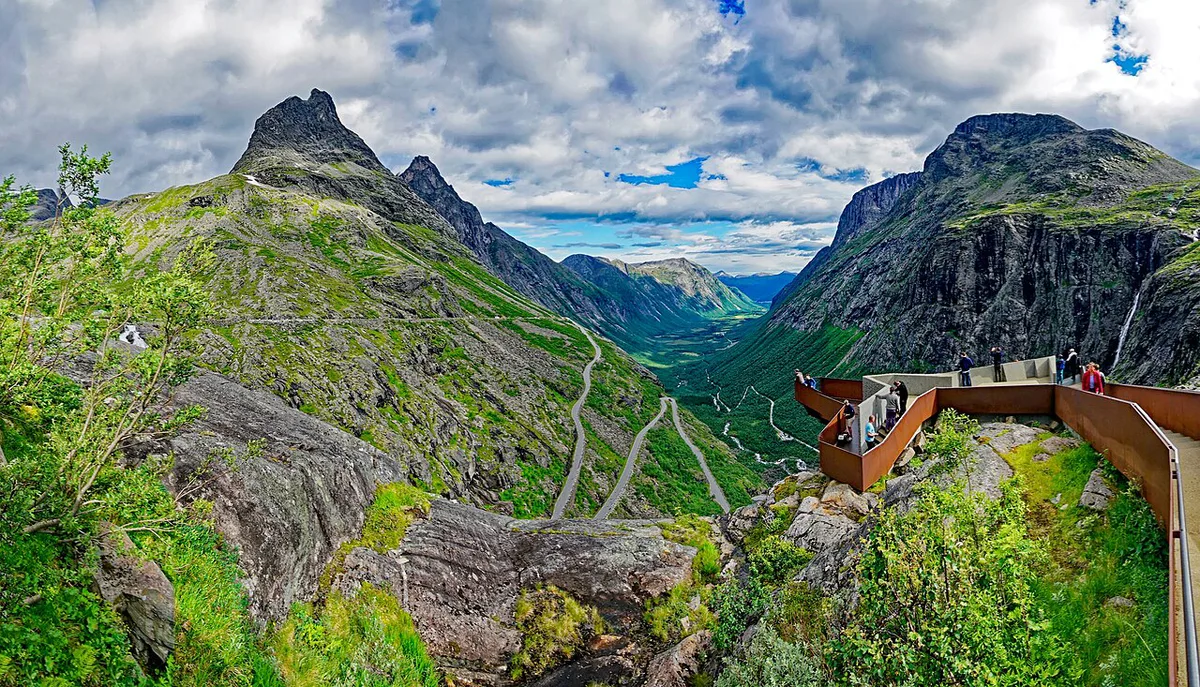
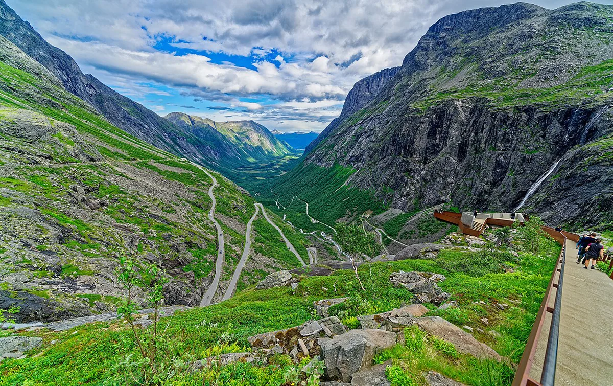
Two architect-designed viewpoints on the plateau look over the bends and the Stigfossen waterfall. Reiulf Ramstad Arkitekter designed the complex, according to Fjord Norway. The visitor centre has a cafe, a souvenir shop, toilets and parking. For a walk, the trail from Trollstigen up to Lake Bispevatnet is described as peaceful. At the foot of the road, an easy circular walk follows the river. Parts of the original pack trail are still passable on foot. Farther along the route, Gudbrandsjuvet gorge and Ørnesvingen, with its view down to Geirangerfjord, are the other named stops.
- Plateau viewpoints and visitor centre, above Stigfossen.
- Bispevatnet trail, from the plateau.
- Riverside circular walk, at the foot of the road.
- Gudbrandsjuvet gorge, between Valldal and Geiranger.
- Ørnesvingen viewpoint, above Geirangerfjord.
How Much Time to Allow at Trollstigen
Official sources give distances, not driving times. The durations below are our editorial estimates for a clear summer day, so add margin for traffic and photo stops. Fjord Norway lists the route as 106 km, while the official route page says 104 km. Use the official figure for planning.
| Plan | What it covers | Allow (editorial estimate) |
|---|---|---|
| Viewpoint stop | Plateau platforms and visitor centre only | About 1 hour |
| Road plus plateau | Drive the 11 bends, stop at the platforms, optional short walk | Half a day |
| Full scenic route | 104 km from Sogge Bru to Langvatnet, with the Eidsdal–Linge ferry | A full day |
Trollstigen With Geiranger: The Full Scenic Route and Ferry
The Geiranger–Trollstigen scenic route runs 104 km from Sogge Bru in Romsdalen to Langvatnet, near Strynefjellet. One ferry crossing, Eidsdal to Linge, sits on the route. Ferry timetables are listed on the official route page, so look them up before fixing a departure time. The section between Korsmyra and Indreeide is prone to landslides, and a year-round tunnel bypasses it. You can add the Geiranger–Hellesylt ferry for a loop of the World Heritage area. That boat passes the Seven Sisters, Friaren and Brudesløret waterfalls.
If Trollstigen Is Closed: Fallback Options
VisitNorway says the Ørnevegen road to Geiranger is open all year, so Geiranger itself stays reachable when the pass is shut. Statens vegvesen publishes which sections are closed and which detours apply, so read it before rerouting. Use the spare day around Åndalsnes instead. The Rauma railway runs from the town, and Norsk Tindesenter houses the Norwegian Mountaineering Museum. Trollveggen, at 1,000 m, is described as Europe's tallest vertical, overhanging rock face.
Ørnevegen to Geiranger stays open all year, so a late opening like 11 July in 2025 still leaves Geiranger reachable.
Where to Base Yourself: Åndalsnes vs Valldal
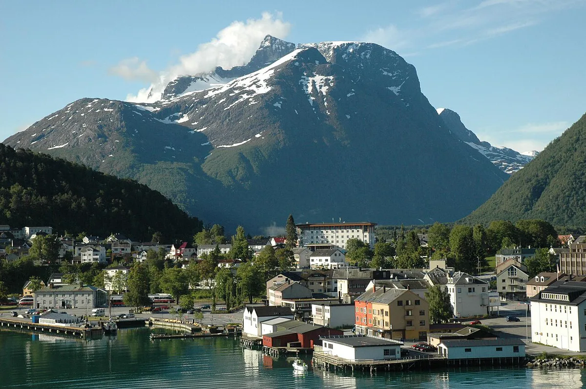
Åndalsnes sits at the bottom of Romsdalen and works as the mountain-activity town. Valldal is a strawberry village on the Sunnmøre side, closer to Geiranger. Choose by the direction you plan to drive.
| Base | Strengths | Trade-off |
|---|---|---|
| Åndalsnes | Rauma railway, Norsk Tindesenter, Romsdalseggen and Rampestreken nearby | Farther from Geiranger |
| Valldal | Kayaking, rafting and cycling, closer to Geiranger and the Eidsdal–Linge ferry | Fewer rail connections |
Trollstigen Costs, Parking and Practical Logistics
Fjord Norway says there is no fee to drive the stretch. Ferry fares on Eidsdal–Linge and plateau parking charges are set by their operators, so look up current prices on the ferry timetable page and at the car park. Park only in designated areas along the route. For toll payment basics, see our toll roads guide. Parking habits elsewhere in the country are covered in our Norway parking guide. Cyclists should note the official warning of heavy summer traffic and a demanding ride. It suggests early June or September.
- Mistake: relying on last year's opening dates.
- Mistake: parking outside the designated areas.
- Mistake: underestimating traffic on the road in high season.
Trollstigen in a Wider Norway Road Trip
Trollstigen is one of the 18 Norwegian Scenic Routes, which our national tourist routes guide maps. Fjord Norway says you can combine Aursjøveien, the Atlantic Road, Trollstigen and Geiranger in a couple of days. Our Atlantic Road guide covers that first leg. Add buffer if you do, because Trollstigen's season is the least predictable link. For a longer loop, use our Norway road trip planner. More options sit in our scenic drives roundup, and the wider rules are in our driving in Norway hub. Northern alternatives include the Lofoten Road Trip: Route, Car Hire, Days and Season and the Senja Scenic Route: Driving Guide & Tips.
Frequently Asked Questions
Is Trollstigen still closed?
In late November, the road is normally closed for winter. Past official closures fall between 5 October and 7 December. Statens vegvesen traffic messages show the live status.
How long does it take to drive the Trollstigen road?
Official sources give the 104 km route length, not a driving time. Allow about an hour for a plateau stop and half a day for the road plus viewpoints, as editorial estimates. The full route with the ferry needs a full day.
Road-rule changes worth knowing
Optional updates to our guides.
You might also like

Continue reading
More guides you'll find useful