
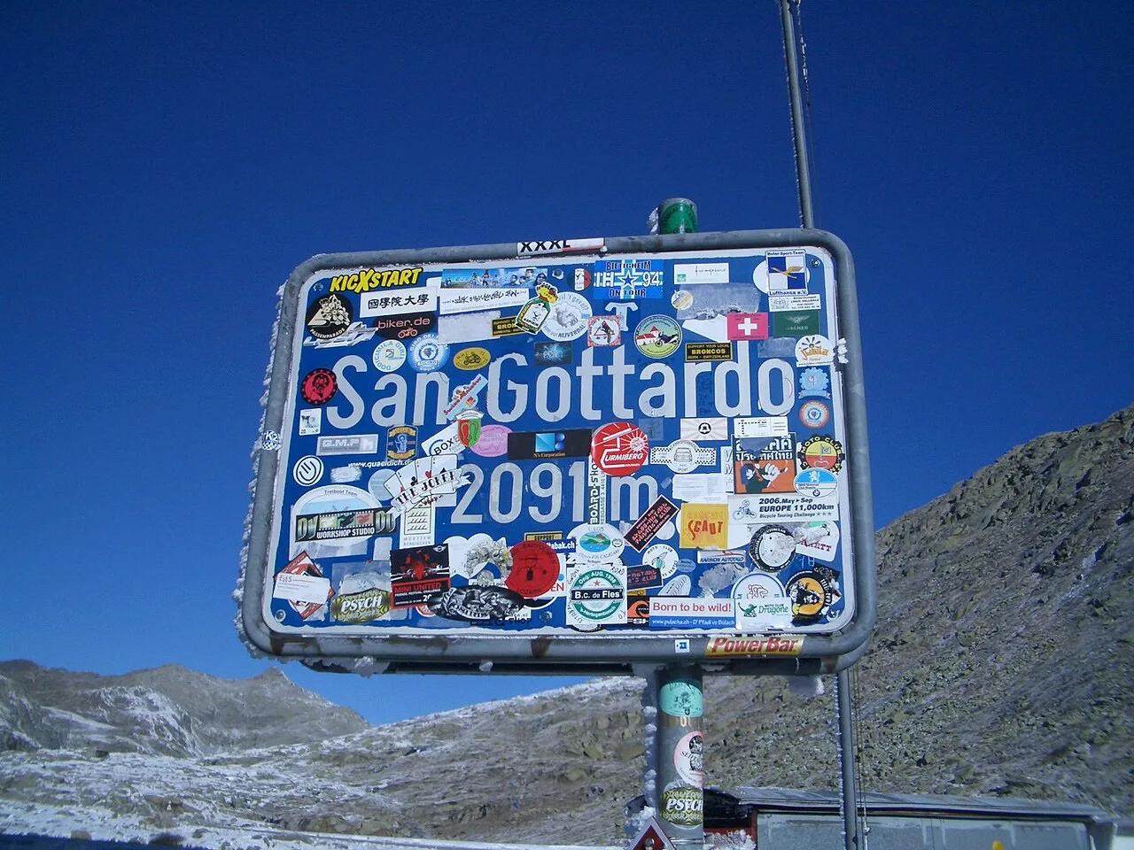
Gotthard Pass: Route, Tremola Road and Tunnel Choice
Plan the Gotthard Pass: how to check if it's open, pass vs tunnel trade-offs, the Tremola road, and which passes to combine it with.
On this page
Last updated November 2026. The Gotthard Pass links Uri in the north with Ticino in the south, and its summit sits at about 2,106 m (6,909 ft). It is a seasonal mountain road, so the A2 road tunnel is the year-round way through. Take the pass when the weather is clear and you want the drive itself, and use our guide to 14 Swiss Mountain Passes: Choose, Time and Route to place it among its neighbours.
Featured image: Nowic, CC BY-SA 3.0, via Wikimedia Commons.
Gotthard Pass at a glance
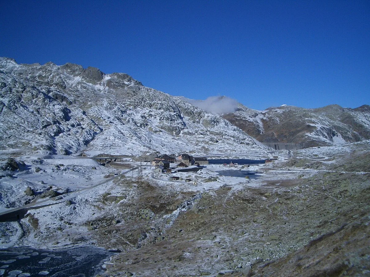
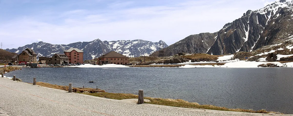
The pass crosses the St. Gotthard Massif between Andermatt on the Uri side and Airolo in Ticino. The summit area holds a hospice, the National Gotthard Museum, a hotel and several small lakes. The pass road is closed to traffic in winter, usually from November to May, so treat it as a summer and early autumn drive. Reaching the summit takes real time, so it suits travellers who want scenery more than speed.
- Location: Uri to Ticino, between Andermatt and Airolo
- Summit elevation: about 2,106 m (6,909 ft)
- Season: usually June to October; closed in winter from about November to May
- Road: Hauptstrasse 2; the old Tremola section is Hauptstrasse 561
- Best for: scenic drivers, cyclists and motorbike riders
- Main alternative: the A2 Gotthard Road Tunnel, open year-round
Which Gotthard do you mean?
The name covers several different things, and mixing them up leads to wrong plans. Each one works differently for a traveller.
- Pass road: the high summit route, seasonal and slow.
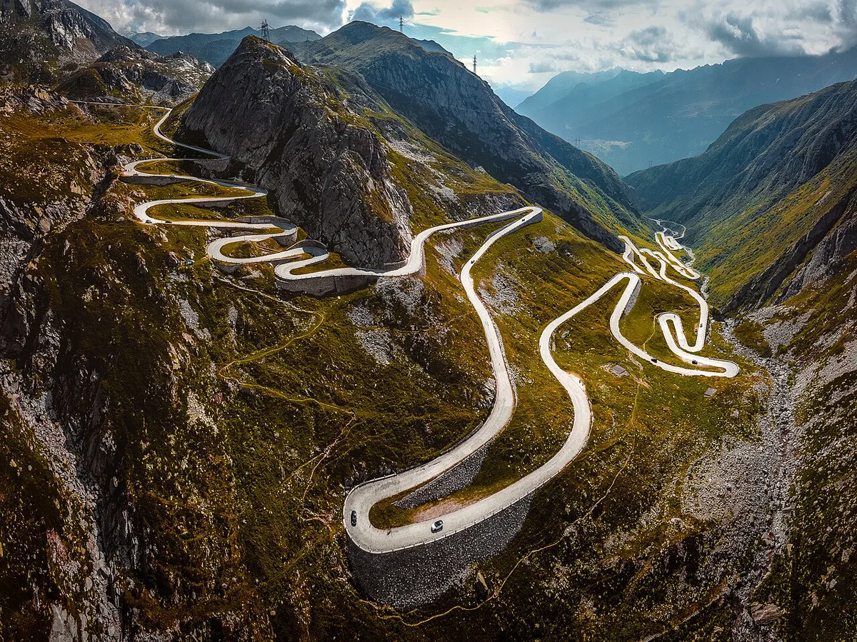
- Tremola: the old cobbled hairpin road on the Ticino side, rising from Airolo.
- Gotthard Road Tunnel: the A2 motorway tunnel, the usual year-round crossing.
- Gotthard Base Tunnel: a rail tunnel only, with no road option.
- Summit area: the hospice, museum and lakes at the top.
Pass, Tremola or tunnel: how to choose
Pick by season, weather and how much time you can spend. The tunnel is faster and ignores weather. The pass costs hours but gives the views. The A2 is a motorway, so the official Swiss e-vignette applies to the tunnel route.
| Option | Season | Scenery | Weather risk | Best for |
|---|---|---|---|---|
| Pass road | Usually June to October | High alpine summit | High: fog, snow, closures | Scenic drive |
| Tremola old road | Same as the pass | Cobbled hairpins on the Ticino side | High: wet cobbles, fog | Short detour from Airolo |
| A2 road tunnel | Year-round | None, an inside view only | Low | Fast crossing |
| Rail tunnel | Year-round | None | Low | Car-free crossing |
When the Gotthard Pass is open and how to check
Snow decides the season. The road is normally closed from November to May, and the exact opening and closing days shift from year to year with snowfall. It has been closed to motor traffic every winter since the road tunnel opened in 1980. Look up live status on the TCS pass status page on the morning you drive. The Swiss Federal Roads Office covers the national road network and tunnel notices. If the pass is shut, drive the A2 tunnel instead and keep your time budget. For another north-south crossing, try the San Bernardino Pass route, which has its own season and status.
- Check status before you leave your hotel.
- Recheck at Andermatt or Airolo before you climb.
- Keep the tunnel as your fallback.
Driving the Gotthard Pass: route and stops
Start from Andermatt for a south-bound drive, or from Airolo to climb the Tremola first. The Tremola section is narrow and cobbled, with tight hairpins, so drive slowly and watch for oncoming vehicles. At the top, stop at the hospice and museum area, at about 2,090 m just south of Lago della Piazza, and walk by the small lakes. Fuel up in Andermatt or Airolo before you start, since you will not find a station on the pass. Plan a half day for the pass alone. Give it a full day if you add photo stops and a lunch break. Fog can hide the views, so aim for late morning in clear weather. Rental cars are usually fine on the pass, but read your contract for restrictions on mountain roads.
- North to south: Andermatt, then the summit, then the Tremola down to Airolo.
- South to north: the Tremola climb from Airolo to the summit, then down to Andermatt.
- Fuel in the gateway towns, not on the pass.
- Photo stops: the summit lakes and the Tremola hairpins.
The Tremola: old road versus the new road
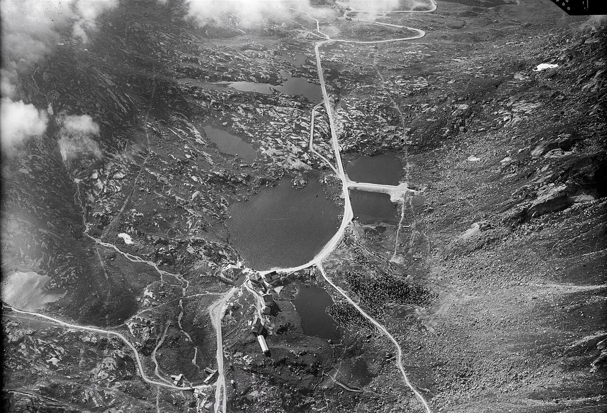
On the Ticino side you have two ways down to Airolo, and road signs do not always make the choice obvious. The modern pass road, built in stages and opened in 1967 and 1977, is wide and fast with long bends. The Tremola is the original carriage road through the Val Tremola, built between 1827 and 1830, and it runs as Hauptstrasse 561 from the summit to Motto Bartola above Airolo.
| Feature | Tremola (old road) | New pass road |
|---|---|---|
| Built | 1827–1830; granite paving laid 1937–1941 | Opened in stages in 1967 and 1977 |
| Surface | Granite setts, restored 2009–2011 | Asphalt |
| Driving feel | Tight stacked hairpins, slow, bumpy | Wider bends, normal mountain-road pace |
| Best for | The experience and the photos | Getting over quickly, wet days |
Drive the Tremola in a low gear, give way where the road is too narrow for two cars, and expect cyclists on the climb. On a wet or foggy day the granite setts lose grip and the views vanish, so take the new road instead and save the Tremola for a dry morning. Both routes close together in winter.
Cycling and motorbike notes
The pass suits fit cyclists and riders who enjoy hairpins. Expect cobbles on the Tremola, which are slippery when wet, and traffic on sunny weekends. Pack warm layers and rain gear, since summit weather turns quickly. Riders should check surface conditions before the climb. Cyclists on the Tremola should leave extra time for the climb and descent.
Riders should expect a summit at about 2,106 m (6,909 ft), where weather turns quickly, so pack warm layers before you climb.
Getting there without a car
Rail runs through the Gotthard Base Tunnel, but it does not climb the pass. Trains stop at Andermatt and Airolo, which makes both towns good bases. Summer public transport to the summit varies by year, so look up the schedules on MySwitzerland and the postbus operator before you plan around it. If no service fits your day, a taxi or a rental car from either town gets you there.
Where to base yourself
Andermatt on the Uri side and Airolo on the Ticino side are the two natural bases. Andermatt is the better pick if you want to pair the Gotthard with the Furka, Oberalp and Susten roads. Airolo puts you at the foot of the Tremola and close to the south side of the Nufenen Pass: Season, Directions and Driving Tips. Book early for summer weekends, when both towns fill.
What to combine it with
Several passes lie close to Andermatt, and loops are easy to build. Pair the Gotthard with the Furka Pass: Season, Drive Time & How to Plan It for a high alpine day. Add the Susten Pass: Season, Driving Route and Tips for a longer circuit. The Oberalp Pass: Road Status, Route & Drive vs Train Tips heads east from Andermatt toward Graubünden. The Grimsel Pass: Opening Dates, Route & Planning Guide sits next to the Furka and extends a western loop. Check each pass's season first, since they close on different dates.
Common mistakes to avoid
Most problems come from timing and weather. Avoid these.
- Setting out without checking whether the pass is open.
- Taking the pass when you need to reach Ticino fast.
- Starting late, when fog and traffic build at the summit.
- Leaving with a low tank and no fuel stop on the route.
- Underestimating how long photo stops take.
Frequently Asked Questions
What are the most beautiful mountain passes in Switzerland?
The Gotthard sits in a group with the Furka, Susten, Nufenen and Oberalp roads, all within reach of Andermatt. Our guide to 14 Swiss Mountain Passes: Choose, Time and Route compares them. Pick by season and by how much time you have.
Road-rule changes worth knowing
Optional updates to our guides.
You might also like

Continue reading
More guides you'll find useful